8 October 2022
I’ve never done one of those VK (Vertical Kilometre) races, where you have to climb 1000 metres in 5k. However, the grassroots fellrunning calendar does have the Wasdale Show Race, 700m of climb in 2k. And unlike a VK, you have to come back down as well. I’d not run this race before either, but having been up & down Kirk Fell a few times I knew exactly what tomfoolery I’d be letting myself in for. Yesterday, a chance to tick another one off the bucket-list.
I was up near Ambleside for work this week anyway, so with a 2pm race start tried to make the most of the day. For a bit of a warm-up, knowing that the Langdale race started at 11am, I parked at the New Dungeon Ghyll at 10.30 and walked up Stickle Ghyll to the tarn to catch the runners coming through. 607 of them entered, according to the list online. It was quite a profound sight to glimpse the pack from far above, advancing up the ghyll like a colony of ants escaping from a disturbed nest. Soon enough, the cream of English fellrunning zipped past, followed in time by the more familiar midpack. Although it was a big field for a fell race, it didn’t feel like 600…. and in fact the results show that 421 started, which seems a pretty high drop-out rate, particularly as conditions were good.
Back to the car for midday, with a couple of hours to get to Wasdale. It’s only a few miles over the fells as the crow flies but the drive is way longer, and as I’d never been over Wrynose & Hardknott before I thought I should give myself plenty of time. Good job I did, Hardknott in particular is a crazy road and combined with a lot of pulling into passing places I didn’t get to the showfield until half 1. Well, at least no hanging around getting cold….
Weather still OK but this is Wasdale Head and it looked like it could change at any moment. A full rainbow cast across the fell and I started wondering about kit. It was warm enough down here so thought just a t-shirt under the vest would be sufficient, plus the obligatory waterproof.
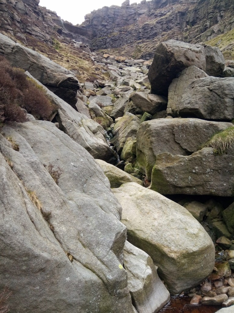
Race underway, a 50 yard dash across the field to a mass stile-crossing, and that’s the last bit of flat until you get back to the same place in an hour’s time, and the last bit of running until you get almost to the top. A running race in which 90% of the climb is a walk….. The first half is up grass steps; seems tough enough until you hit scree further up. The scree was diabolical, one step up, two down. I started scratching around for anywhere with grip, and took an off-piste traverse to the right. Sure enough, an easier line, and a mental note to return the same way. Two thirds up and the race leader runs past me on the way back down; he’ll be done and on the way home by the time I get back. A nasty squall comes over so it’s waterproof on as we pick our way over easier ground to the top. Respect to the MRT guy who is stationed at the cairn, checking us through.
And now the descent. I’d tried to pace things on the climb so that I’d have something in the legs for coming down. It’s not so much about getting out of breath on this race, more whether your legs are still functioning by the finish! The first bit OK, but there was no avoiding a stretch of steep scree, some of it runnable but much badly eroded and just a slide. All about keeping your balance and getting down in one piece. Eventually, back to the grassy steps…. potentially quicker lines were available to the side but the squall had left them awkwardly greasy, so I kept to the steps for better grip, even though this was much more quad-destroying. At last, the stile again and an undignified jelly-legged waddle across the field to the finish. Straight to the river for nature’s own ice-bath treatment, hopefully the stiffness won’t be too bad this week.
There probably aren’t too many 4k races where it feels an achievement just to finish, but I was pleased to get round & do so in under an hour. And then just the small matter of the 3 and a half hour drive home. The late afternoon sun was out and it felt dreamy and other-worldly on the narrow West Cumbrian roads around Black Combe – never been up there before so one to return to. 3 and a half hours to drive to a 1 hour fell race, sounds daft…. promise I won’t do it again for, er, at least a week – Fell Relays in the Scottish Borders on Saturday!