Leeds Country Way in a day

One of my bright ideas for 2020 was to run the Leeds Country Way (LCW) – an approx. 60 mile off-road circuit of the city – in a single day. Due to a combination of COVID, illness and simple fear, in 2020 I never quite attempted it. I did however do plenty of research and preparation, including running 2 full circuits in various stages. So, for the benefit of anyone else thinking of taking on this challenge, here are a few thoughts and experiences.

Route options

The first thing to decide is which of 2 route options to take. Runners conventionally follow the route of the annual LCW Relay, which uses the original line of the LCW, and clocks in around 64 miles. The advantages of this option are:

  • there are historical records going back some years
  • it is good preparation for the Relay.

However, due to local government reorganisation, in 2006 a 15-mile section of the Way was significantly re-routed. Rather than skirting the edge of Wakefield, the Way now takes in Carlton, Thorpe and East Ardsley. The advantages of taking this option are that it:

  • follows the official line of the Way, as it appears on current OS maps, and is better signposted accordingly
  • is more in keeping with the spirit of a “Leeds Country Way”, being closer to Leeds and more in the countryside
  • is arguably a more scenic, interesting run
  • is overall around 4 miles shorter (!)

The choice is up to you. I ran them both and found the revised line preferable, so my further comments below presume this is the route.

Solo or supported?

Any ultra run is potentially so much more doable if you have other people supporting you, whether running alongside, meeting you at road crossings, or both. You just run – your supporters find the way, pace you correctly, carry the food/drink/kit, keep you cheerful, take you to the pub/home at the end etc. And running “close to home” means it may be easier to organise these logistics than for challenges further afield.

This does mean though that going alone becomes more possible. There are refreshment stops en route, the terrain is gentle and navigation (while convoluted) is relatively straightforward. On a good day you wouldn’t have to carry too much kit. There are numerous opportunities to bail out if you’d had enough. Theoretically, you could save yourself the trouble of organising a support team, and of over-relying on it.

Start/finish point

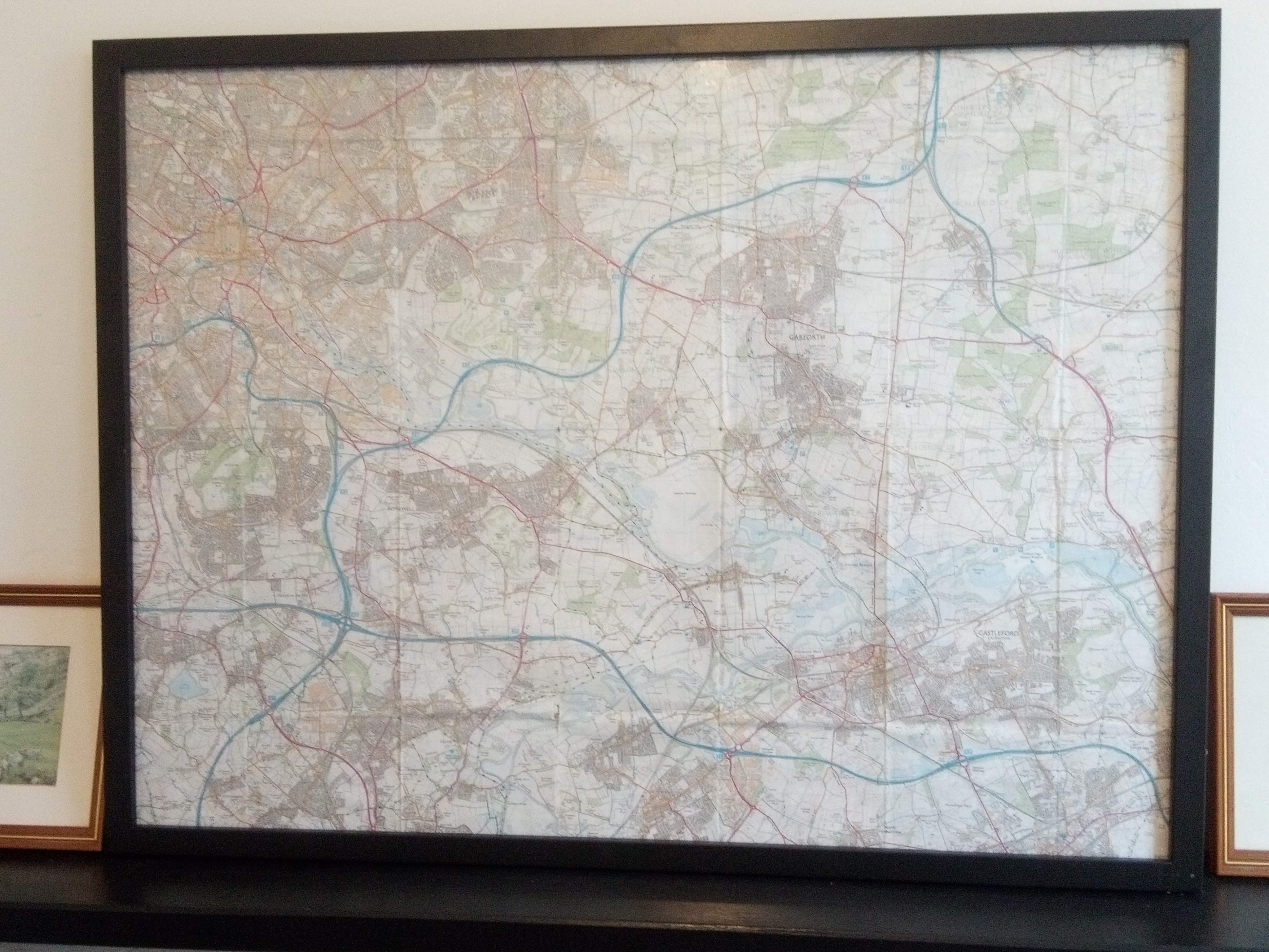
You can start/finish the circuit at any convenient spot. Obviously, parking and distance from home are factors…. but also think about the location of refreshment stops. When doing my recceing I found good shops right on the Way only at East Ardsley, Thornbury, Barwick and (particularly) Garforth, so plan accordingly.

Clockwise or anticlockwise?

The Relay is run clockwise and somehow it seems intuitive to go in this direction. However, there is no reason not to go anticlockwise. Again, location of refreshment stops and the start/finish may influence your decision.

Time of year

Overall I found spring the best time to run on the Way. Over winter it can be a real mud bath, and obviously it’s cold and daylight is limited. Midsummer can be too hot for a long run, and in late summer/early autumn parts get overgrown. Late April to early June could be good. Historically, times of between 12 and 17 hours have been recorded, so factor in your likely pace (and how much you like the idea of running in the dark).

Training and recceing

Having broadly scoped out how you’re going to approach it, it’s time to put the hard work in. And perhaps the best way of building up your mileage is to do it on the Way itself. There is so much to learn from becoming familiar with the route – navigation, underfoot conditions, climbs & descents (total ascent is around 1400m), distances between landmarks, your likely pace, location of refreshment stops/support points etc etc. The route is divided into 4 sections on the Council website (the relay route 6) and – perhaps with the help of public transport – you could do each section first, then build up to 2 sections and so on.

Personally, I found doing 2 full circuits in preparation (one in winter, one in summer) extremely useful. Not least as it helped get the route “in my head”. I also felt better able to prepare for different scenarios on the day.


Postscript (May 2021)

Despite doing 2 circuits of the route in various stages, in 2020 I never completed the full circuit in a day. However, on 7 April 2021 I made another attempt, this time successful – see my write-up on my running club’s website. I took the current route anticlockwise, starting and finishing at Swillington Bridge. I was “Solo Self-Supported”, meaning I travelled alone, didn’t meet anyone pre-arranged, and carried all my kit and food (or purchased it en route). My time was 14 hours 12 minutes, meaning I just about got round in daylight! (For the record, the best time for the route is 10:41).

Woodhouse Ridge maprun

Here’s a new virtual racing idea for Leeds runners to try out. It’s a 4km circuit of Woodhouse Ridge and Sugarwell Hill, using a free app called MapRunF. You can run it at any time, and there are route options on different surfaces as you prefer. Once finished, your time gets uploaded to a results page, so you can see how you got on straight away.

To access the event, download the app to your phone and, once registered, go to Select Event > UK > Aire Valley > Valley Striders > Woodhouse Ridge Maprun. Info on how to get and use the app can be found on the Maprunners website

The Start (and Finish) point is the pelican crossing on Meanwood Road close to the junction with Buslingthorpe Lane. When you are ready to set off, press “Go to Start”, and shortly afterwards your phone should beep and the clock start ticking. You then have 3 “virtual checkpoints” to visit, in the following order:

1: Junction of Wood Lane and Shire Oak Road
2: Pelican crossing on Meanwood Road, close to junction with Boothroyd Drive
3: Stile at entrance to Sugarwell Hill, at the end of Sugarwell Mount

As you run through each checkpoint you should hear your phone beep (it can help if you turn the media volume on your phone up before setting off).

Once through the 3 checkpoints, you need to return to the starting point, where your phone should beep a final time and stop the clock. If your phone is connected to the internet, your time should be uploaded automatically to the results page. If not, you can use the Upload (Manual) function when you have a connection.

The route you take is up to you. There are both muddy-trail and firmer-underfoot options available, so select your footwear accordingly. You might want to recce your different options in advance.

Obviously, please take care when crossing roads (the pelicans on Meanwood Road have been used as checkpoints for good reason!).

The route is summarised on the map below. Happy maprunning!

Running through the field

Blog Tour Banner - All or Nothing at All

Preview of “All or Nothing at All – The Life of Billy Bland”, by Steve Chilton

You could be forgiven for asking whether a fellrunner, any fellrunner, merits a biography. Fellrunning is an obscure sport, largely unknown outside its mountainous heartlands. And despite a host of revered characters going back through the decades, no individual fellrunner has ever broken through to wider public awareness. As such, I’m not aware of a conventional, widely-read fellrunning biography.

Perhaps this is looking at things the wrong way. Previous fellrunning-themed books have communicated the essence of the sport by patching together its various elements – races, challenges, records, rivalries, personal experiences of the author and its humbler participants… as well as brief profiles of elite performers. So perhaps a fuller length biography of one-such elite performer can provide us with a refreshing new angle on the sport?

The signs are promising from my sneak preview of “All or Nothing at All”. Employing a technique successfully used in his previous book about the Bob Graham Round, the author faithfully records interviews with its former record holder – Billy Bland. And we get a pleasant surprise – in the one chapter I’ve seen, in this biography of a fellrunner, fellrunning isn’t mentioned.

The gist of Billy’s running career is already well-recorded. Now in his early 70s, he’s lived all his life in Borrowdale (one of the most dramatic, and visited, valleys in the Lake District), where he worked locally as a stonemason. His running on the local fells combined an obsessive training regime, meticulous knowledge of the landscape, an ability to move quickly over difficult terrain, and innovative race tactics (such as deliberately going the wrong way to elude trailing runners, or hanging back at the start line then running through the field to avoid being followed!). The reward was a decade of race wins, including some astonishing records. That his 1981 time for his local Borrowdale Fell Race still stands as the quickest today says it all.

So much, so good. But what does this biography reveal that we don’t already know?

If people want to come up here to walk then fine. But I would put a traffic barrier at the bottom end of Borrowdale….. and bus people in, or let them cycle in or walk in. It would work I am sure it would. People would still want to come up here, especially if it was different to other valleys. The locals could have a pass for the barrier.

A typical quote from the interviews with Billy. Apart from traffic, we hear his views on various topics of Borrowdale interest – wildlife, agriculture, tourism, second homes, fox-hunting, local services….. he’s got a strong opinion on all of them. But why should a former sportsman care about stuff like this?

This is perhaps the key to why this biography may be worth your attention. It is somehow dissatisfactory to describe fellrunning simply as a “sport”. Sport, as we generally experience it (whether as a participant or spectator), normally takes place in a separate, dedicated arena, designed for the purpose. By contrast, fellrunning takes place in a natural landscape, with races often organised by local communities. Its roots make it as much part of upland culture and tradition as a sport.

Agree or disagree with Billy’s views as you wish, but it’s just great to know that someone who made their name running through Borrowdale actually cares about the issues affecting it today. Well-publicised post-Lockdown scenes of overcrowding and littering have included Borrowdale, where the tension between dramatic scenery and relative accessibility has always been acute. For example, when I lived in Borrowdale in 2019, at the YHA, I would despair at the sight of the overwhelmed car park at weekends in summer. Cars parked on the verges and camping field, tyre tracks left behind…. soon to be followed by a drive skirting dozens of pedestrians and cyclists alongside Derwent Water (no fun for them either) and a long queue to get through Keswick. Billy’s suggestion of a traffic barrier may seem extreme, but it seems reasonable that the events of 2020 should at least allow radical ideas like this to be discussed.

As we emerge from Lockdown, we look for suitable ways forward in all aspects of life. For fellrunners, Billy’s story – the connection with his local patch during his running career, and his abiding interest in it after – seems like a good example to follow. If, like me, your local library is still shut, and you’re on the lookout for a decent book to buy, this new biography looks like a good bet.

fullsizeoutput_2371

‘All or nothing at all’ will be published on Thursday 20th August and can be obtained from all good bookshops and online at Amazon. Live book launch, Thu 20 Aug 6.30pm

About the book

All or nothing at all: the life of Billy Bland. Sandstone Press. Format: Hardback. ISBN: 9781913207229. Publication Date: 20/08/2020 RRP: £19.99

All or Nothing At All is the life story of Billy Bland, fellrunner extraordinaire and holder of many records including that of the Bob Graham Round until it was broken by the foreword author of this book, Kilian Jornet. It is also the story of Borrowdale in the English Lake District, describing its people, their character and their lifestyle, into which fellrunning is unmistakably woven.

About the author

Steve Chilton is a runner and coach with considerable experience of fell running. He is a long-time member of the Fell Runners Association (FRA). He formerly worked at Middlesex University as Lead Academic Developer. He has written three other books: It’s a Hill, Get Over It; The Round: In Bob Graham’s footsteps; and Running Hard: the story of a rivalry. He has written articles for The Fellrunner, Compass Sport, Like the Wind and Cumbria magazines. He blogs at: https://itsahill.wordpress.com/

13 Pillars of Wisdom

In my last blog I mentioned I’d started “collecting” 13 local trig points (“pillars”, strictly speaking), as one of many ways of keeping running interesting during Lockdown. Well, all 13 are now in the bag. So, I thought I should “report back” on what I’ve found. Both to give a flavour of the current condition of these iconic (but sadly redundant) landmarks, and also to reflect on whether the act of searching for them was worth all the bother.

I list the pillars below in alphabetical order. All were visited on a run from home and appear on the 2000 edition of the OS 1:25000 map of Leeds South (slightly trimmed to fit into a frame).

img_20200330_183725I live somewhere near the centre of the map and, on average, it took around an hour to run to each pillar (well within my comfort zone). Of course, physical distancing was observed at all times. More information about the pillars – location, reference number, visits by others etc – can be found on the TrigpointingUK website.

  1. Barnbow Wood – Destroyed. Although I passed near the site of this one after searching for nearby Brown Moor (see below), I confess I didn’t actually go looking for it, as it was recently reported destroyed for agriculture.
  2. Brown Moor – Inaccessible. The obvious route to the pillar is blocked by ongoing works at the new Thorpe Park development. Plans do suggest though that a new path will be built that passes right next to the trig.
  3. Crow Nest – Good. You can’t actually touch it because it’s in school grounds, but it’s easily seen from the other side of a fence (probably best visited outside school hours then). It has the best view from these 13, perched over the city centre with the football ground prominent in the foreground.
  4. Field Head – Inaccessible. It’s in the grounds of a hospital. I got to the entrance but judged it not a good time to go beyond that point just now.
  5. Garforth Cliff – Good. Tucked out of sight behind a water tower. Saying that, the farmer couldn’t have ploughed any closer without damaging it.
  6. Halton Moor – Destroyed. Got to where the pillar should be to find it’s just the embankment of a road serving a new business park.
  7. Holywell Wood – Inaccessible. Quite a tricky one this. I had to go a little bit off-piste and after some searching saw it in thick undergrowth the other side of a barbed-wire fence. I wasn’t going any further than that.
  8. Hook Moor – Toppled. The pillar is located close to the junction of the M1 and A1(M) and was “unseated” as part of the road construction a few years ago. At least the roadbuilders left it close by (and in good condition) as it reveals the full “anatomy” of a pillar – ie that it is iceberg-like, with as much below the surface as above.
  9. Peter Lane – Good. Tucked into a hedge next to a quiet footpath.
  10. Robin Hood Hill – Inaccessible. It’s at the top of the embankment of a main road and separated from it by killer thorn bushes. All I got for my attempted visit was a shoe-full of spikes. I’ll take my machete next time.
  11. Scotthall – Good. The most visible of all the pillars, being in the central reservation of a main dual carriageway into Leeds. It’s almost possible, on a quiet day, to pull the car up alongside it, wind down the window, and touch it from the drivers’ seat (don’t ask me how I know this).
  12. Tingley Hill – Good. My favourite of the 13. It was actually recently re-located a few yards as part of a housing development. Bless them, the developers made it the central feature of a circular garden, giving it the air of a stone circle or some other ancient sacred site. The only shame is that, now it’s been relocated, it no longer appears on the current OS map.
  13. Thorpe – Good. Similar to Scotthall – right next to a road with distant views.

Well, the obvious sad fact is that only 6 of these 13 are in good condition and accessible. The remainder are either toppled, inaccessible or destroyed. And now that pillars no longer fulfil their original function – OS mapping has been done digitally since the 1990s – there is little that can be done, legally, to protect any under threat. Indeed nationally, there are only around 7,000 pillars left out of the original 10,000. A shame, because they have historic and educational as well as sentimental value. I guess the best suggestion is to continue logging visits on TrigpointingUK, sharing photos on social media etc, to at least keep their profile up. The COVID Trig Point Challenge! group on Facebook does this admirably.

On a more positive note – and while it’s of course disheartening to run several miles to visit a pillar only to find it’s disappeared under a bulldozer – the act of hunting down the trigs has been a real find under Lockdown. Mainly because, it’s made me visit places I would never otherwise have gone to. I don’t think I would have thought of going for a run around Castleford or Belle Isle, for instance, but I got to visit the birthplace of Henry Moore in the former, and the wide roadside verges of the latter were perfect for physical distancing. The abandoned golf course in Middleton Park was another good find for the same reason, plus I got to see the park’s famous carpet of bluebells. One of the more eccentric discoveries was the curved, pitch-black 100-yard tunnel by Parlington Hall, built by the rich nobs in the 19th Century to keep the hoi polloi out of sight as they passed the hall. Next time I’ll remember my head-torch!

Only problem now is – all 13 done, so what next? Lockdown looks likely to continue. Maybe Blue Plaques – there’s 171 of them in Leeds. Follow me on Strava to see my latest bright ideas.

Exiled from the fells

img_20200412_152103
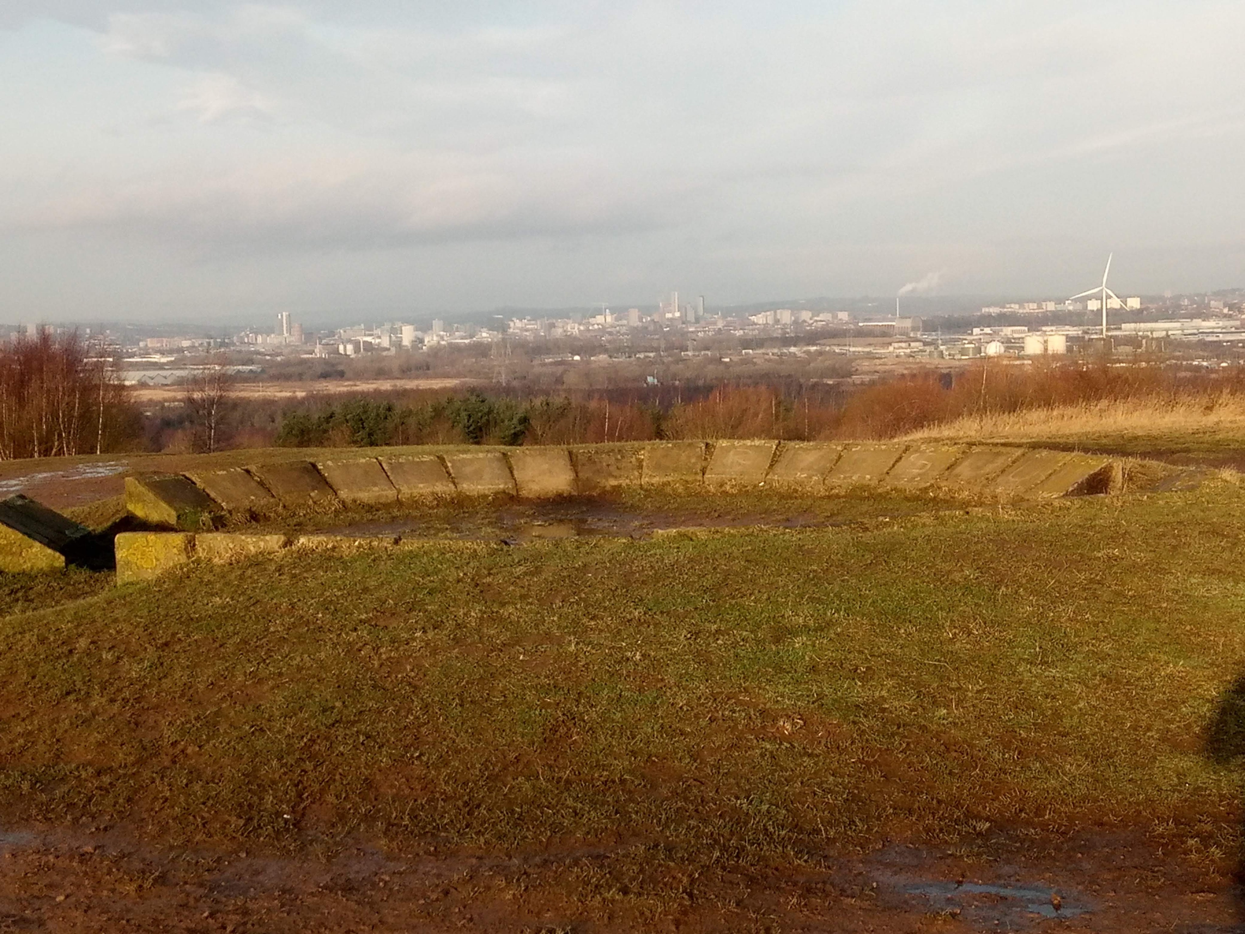
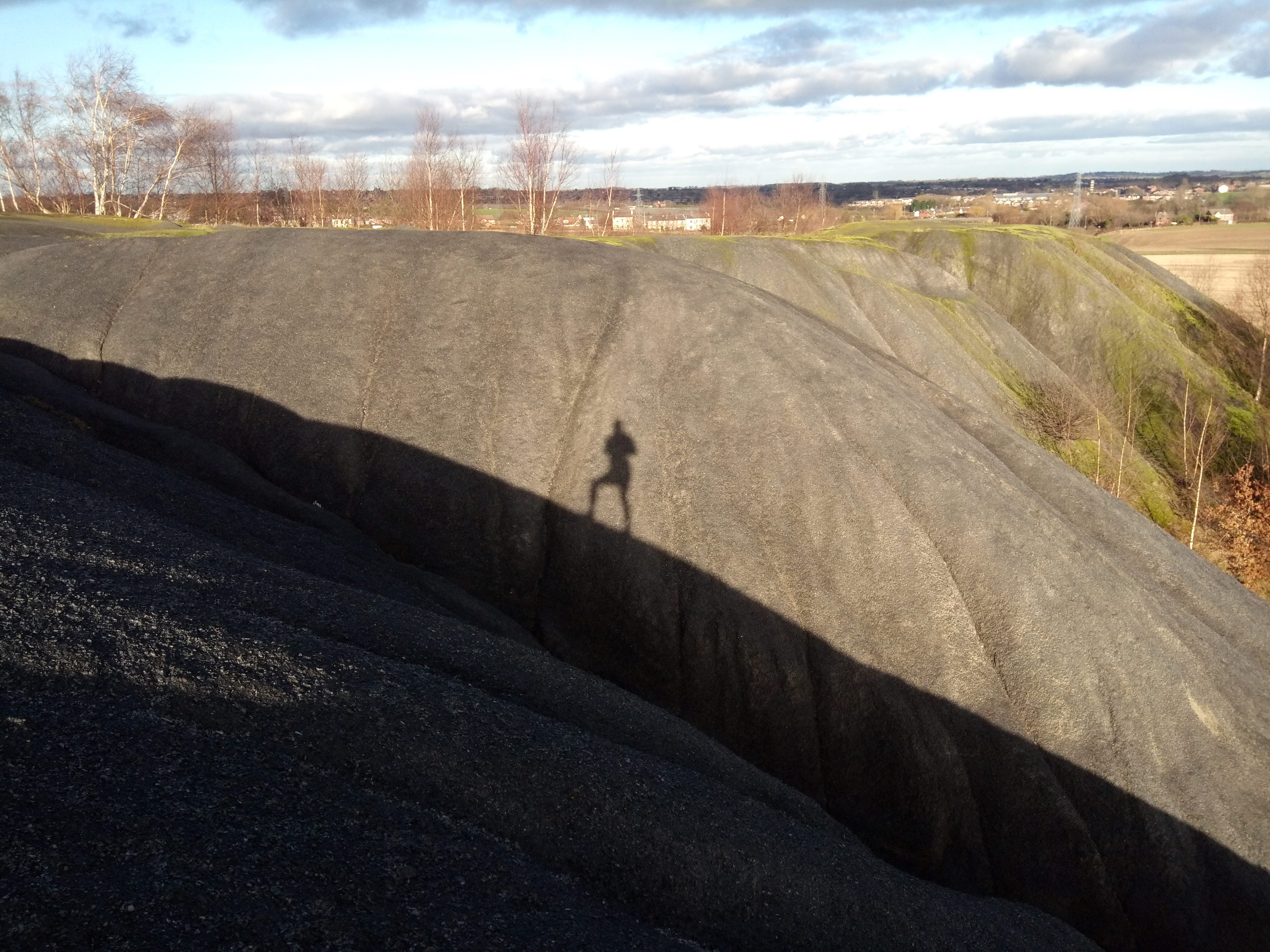
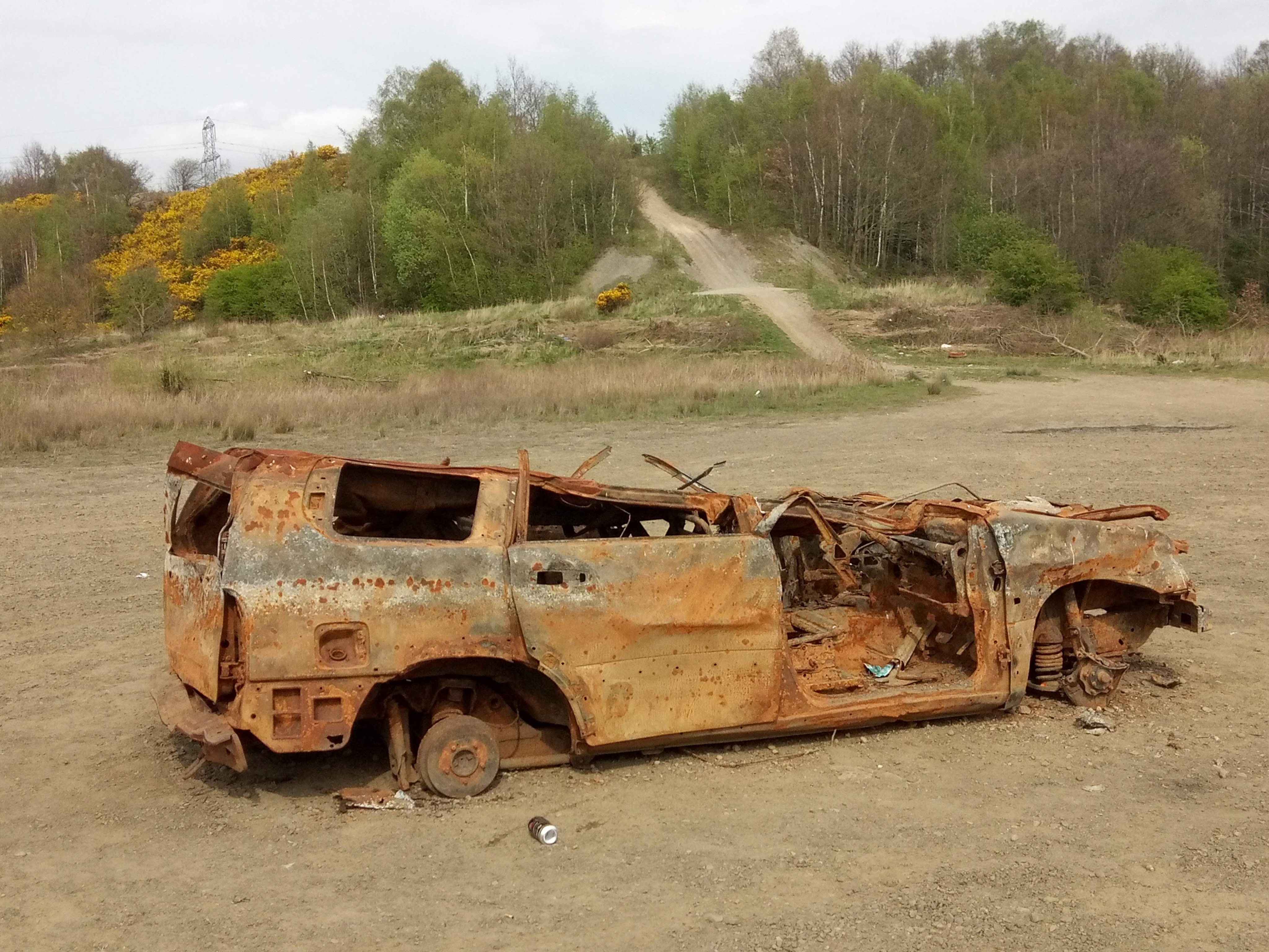
Closed landfill sites. Spoil heaps. Abandoned 4×4 off-road tracks. Wasteland. This has been my running “scenery” for the last month.

Back in February – when the world was a different place – my last running blog looked at how to keep the spirit of low-key fellrunning alive when confined to the city. That was inspired simply by the normal limitations of living in town over winter – distance from the fells, bad weather, limited daylight.

We have new normals now, of course. In terms of running, we run from the door. We maintain social distance. We run within our limits. But we can, at least, run; in fact, we have official blessing to do so (once a day). And it turns out some of the tips from that previous blog have come in handy.

Lockdown brought overnight adjustments. Planned races and trips to the fells abandoned. The entire map collection shunned in favour of the one, local OS 1:25000 (in my case, Leeds South). A first glance of the map to find the obvious open spaces and rights of way within reasonable distance of home.

img_20200330_183725Then you get out there and find everyone else has had the same idea! Even at what you thought would be the quieter times. Pick a narrow footpath and sod’s law there’s someone already on it, and an awkward “passing” to be negotiated. Social distancing is not as easy as it seems.

A second, obsessive scour of the OS map (and, I confess, of Google Maps too). This time my eye is drawn to the obscure footpaths that don’t really go anywhere, to “Disused Workings” and “Spoil Heap (dis)”, to the unclassified rough ground and the totally white squares that just seem to be a blank.

At least here you can feel relaxed about hardly seeing anyone (funny how these areas used to feel “dodgy” for exactly the same reason?). And you get to go “beyond the map” by finding features not marked. A decent hill training area, courtesy of an abandoned quarry face. An up-and-down cross country circuit, previously a banger-racing course. Abandoned ground next to a landfill site, as “wild” an area as any you’ll find on the fells (with an added whiff of methane to boot).

As a kind of sideline to keep those long-lost fells in mind, I’ve also located 13 trig points on my map and started “collecting” them. The contrast between these urban trigs and the iconic hilltop pillars so familiar to the fellrunner is mildly amusing. So far I’ve visited one on a busy roadside verge and another tucked behind a water tower. I’ve failed to access 3, due to development, overgrown vegetation and hospital walls respectively. I visited the site of another that had recently been swept away by a business park development. Still on my list is one that is no longer on the map…. because it’s been re-located 50 yards away as part of a housing development and given its own “feature garden”(!). The key thing is that trigs are not confined to the fells – they are everywhere, and I recommend the TrigpointingUK website accordingly (an absolute goldmine of useless information to help you while away the hours).

These are tough times no doubt and it’s easy to get demoralised….. but there are some positives. Running has been officially endorsed by the government as a good thing, something we can do every day. Less traffic, pollution down, more wildlife to be seen. Many (like me) are on furlough, with more time and energy on our hands – we can go running when it suits us, rather than “fitting it in”. And we’re getting to visit places we wouldn’t otherwise have seen.

And we know the fells will still be there for us in time.


Rural running, in the city

img_20200113_095034

View of Leeds from Rothwell Country Park, on the site of the former Rothwell colliery

Picked up one of my favourite running books the other day – Running Free, by Richard Askwith. First read it a couple of years ago, and no doubt it’s been a big influence on how I’ve gone about my running since. It shuns the conventional, “urban” style of running – based on roads, gyms, times, expensive kit, big events etc – in favour of a “rural” style emphasising the sheer joy and fun of running: inexpensive, off-road and closer to nature.

I spent much of 2019 putting this into practice when living and working in Borrowdale in the Lake District, a fantasy-land for the “rural” runner, as outlined in my most recent blogs. Equally, the author describes similar experiences running through the fields and woods close to his home in rural Northamptonshire.

There seems to me a logical next step from this. Some people live in the countryside permanently, others temporarily, and most of us will visit from time to time. However, fact is that 80-90% of us live in towns and cities, so day-to-day are not able to practice “rural” running in a rural setting. It would seem pretty important, then, to establish whether it’s possible to practice rural running in an urban setting, so that it’s theoretically available to most.

This is only too apparent to me. Having finished my summer job in Borrowdale in October, I moved back to Leeds, where I’d previously lived since 2005. Over these last 3 months, I haven’t gone out and bought a pair of road shoes, or joined many of my running club’s road interval sessions or signed up for the Leeds Half Marathon. Instead, I’ve been trying to find various weird and wonderful ways of keeping my running varied, interesting, low-cost (I’m not currently blessed with a well-paid job) and, perhaps most importantly for me (a creaky 47 year-old with dodgy knees), off-road. It’s been particularly challenging in these cold, dark winter months, but I’ve given it a go!

Here, then, are 10 top tips for “rural” running when living in a big city, based on my experience of running in Leeds:

  1. Don’t run in road-shoes, run in trail shoes. Road shoes are only good for tarmac (and some will question even that), so if you wear them, you won’t go anywhere else. Whereas, trail shoes allow you to run on all surfaces – paths, grass, mud, and the occasional unavoidable stretch of tarmac – giving you the choice to wander at will.
  2. Seek out the green space. Every town or city has some green or wild space. Parks, woods, fields, nature reserves, accessible reclaimed land, cemeteries, estates, canal towpaths etc. Edinburgh even gets its own city-centre mountain (Arthur’s Seat). Get a decent map and start linking it all up. I’ve recently moved to the Woodlesford area of Leeds which is blessed with enormous stretches of accessible open space, mainly reclaimed from old collieries. Exploring it has been a great way of getting to know the local history of my new patch.
  3. Join a club that does trail/fell running. At my count there are 8 running clubs in Leeds affiliated to the Fell Runners Association (FRA). Indeed many FRA-affiliated clubs are urban-based. An obvious way of finding out about suitable training sessions and races and meeting like-minded people.
  4. If it’s dark, you don’t just have to stick to well-lit pavements (or retreat to the gym). Grassy verges and central reservations are not bad options. In Leeds, the outer ring road, Easterly Road and Leeds Road through Rothwell provide some good well-lit grassy runs. And a decent head-torch gives you the option of getting off the roads at night if you wish.
  5. Find a “green wedge” into the city and run out into the countryside. In Leeds, the obvious example is the Meanwood Valley Trail, which links up with the Dales Way. It’s possible to run mainly off-road from Leeds city centre to the Lake District! (I’ve blogged about this in the past). Our other good option here is the River Aire and accompanying canal, in both directions. Sheffield, I know, has even more options.
  6. Urban ultras. In Leeds we are blessed with a 64-mile continuous trail circling the city – the Leeds Country Way. Many other places have something similar. I jogged round the LCW in 2 days over January, and it was a great way of exploring the varied but, to me, largely unfamiliar edge of the city. And of recce-ing the route of Leeds’ equivalent of the Bob Graham Round. And unlike the real BGR, there are plenty of shops, pubs and cafes en route!
  7. Invent challenges and other running “games”. I had some good fun last year inventing the so-called Meanwood Valley 3 Trigs Challenge, based on that icon of the wild places, the trig point, and was flattered that a few people gave it a go. Also, particularly runnable stretches of ground can be made into Strava segments and then be “raced” – I found a fast 2k, all downhill, through Gledhow Valley woods that I enjoyed running flat-out a few times. I’ve heard of night orienteering in city woods too, which sounds like a laugh.
  8. Run the urban fell and trail races. As far as I’m aware, there are 2 races in the FRA calendar within the City of Leeds boundaries – Otley Chevin and Danefield Relay. Local clubs organise a number of trail races, such as Boxing Day’s famous Chevin Chase, the Meanwood Valley Trail race, Guiseley Gallop etc etc. And, increasingly, there are some commercial trail races too – Holly Hustle, St Aidan’s Winter Beast etc – just a google search away. Some of the city’s many parkruns are more interesting than others….
  9. Seek out the mud. There will be stretches of muddy path in every town or city in winter time. So, instead of avoiding it just enjoy the fun of running through it! There is a particularly good 10-minute muddy loop at the top of the Meanwood Valley Trail near Stairfoot Lane car park, incidentally.
  10. Spoil tips. I had a few fun experiences in Borrowdale running down the spoil tips of the old mines at Honister and Seathwaite, so was pleased to find something similar from an old coal mine on the outskirts of Rothwell. A bit like scree-running on a damp sponge, but without any environmental guilt (see below).

Well, there’s probably more on this theme, and I’d be interested to hear anyone else’s ideas. Elsewhere on this site can be found lengthy discourse about my attempts to help save just a small wild space in Leeds from development a few years ago. Returning to the city after almost a year in Borrowdale, which is blessed with wilderness aplenty, has reminded me of the essential need for wild space close to where the majority of people live as well.

img_20200204_144241-1